 |
Home About Directory Conservation |
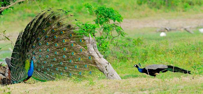 |
Wetland Cluster within Bundala National Park Location: 60 13’ 15 N and 8108’ 0 E to 60 8’ 0 N and 810 16’ 30 E; 687157 N and 514750 E to 677951 N and 529505 E; about 250 km southeast of Colombo in the Hambantota District of the Southern Province. Area: Total area of National Park is 3,698.010 ha; of which 1,990 ha are wetlands. Altitude: Near sea level Overview: The wetlands within the Bundala National Park consist of 4 shallow brackish water lagoons, salt marshes, mangroves, salterns, seasonal water holes/tanks and streams and the seashore. The adjacent seacoast and surrounding terrain is generally flat with sand dunes and sparse dry evergreen scrub. This biologically rich area is an internationally important wintering ground for migratory water birds, the highlight being the Greater Flamingo (Phoenicopterus ruber). In 1991, Bundala became the first wetland to be declared as a Ramsar site in Sri Lanka. Physical features: The area is underlain mainly with hornblend-biotite gneiss of the eastern Vijayan series and can be divided into three main relief zones: beach and sand dune area; immediate inland coastal plain including the lagoon area; and hinterland of the eroded peneplain forming the undulating country of low hill and wide valleys. The low country dry zone climate prevails in the area, with an average annual rainfall of 1,074 mm. The mean annual temperature is around 270C, with a maximum of 300C and a minimum of 240C. The average relative humidity is 80%. Of the four lagoons, Bundala (520 ha) is a brackish water lagoon with an average depth of less than 1 m, separated from the sea by a natural sandbar. Part of the Bundala lagoon has been converted into a saltern. Embilikala (430 ha) is a low saline lagoon immediately west of the Bundala Lagoon. Malala (650 ha) is similar to Embilikala and is connected to it by a narrow channel. It receives freshwater from the Malala Oya Stream. The westernmost lagoon, Koholankala (390 ha) has been developed for salt production and is subjected to widely fluctuating water levels. Salinity levels exceed 30 ppt during dry periods. Ecological features: The area consists of seven major terrestrial vegetation/habitat types (dry thorny scrubland, arid zone forests, sand dune vegetation, gentle sea shore vegetation, arid zone maritime grasslands/pastures, riverine forests, anomalous Mesquite scrublands) and six wetland types (salt marsh, mangrove, brackish water lagoons, sandy and rocky sea shore, seasonal water holes and tanks, salterns). A total of 383 plant species have been documented from these habitats, with dry thorny shrubs and herbs being the predominant plant life in Bundala. A very small and degraded patch of mangrove can be found at the Bundala lagoon outlet area, consisting of Lumnitzera racemosa. 324 species of vertebrates have been recorded, which include 32 species of fish, 15 species of amphibians, 48 species of reptiles, 197 species of birds and 32 species of mammals. Among the invertebrates, 52 butterfly species are included. Noteworthy fauna: The fish species present in the Bundala wetlands include salt-water dispersants (Anguilla bicolor), marine forms (Ambassis gymnocephalus), brackish water forms (Chanos chanos) and freshwater forms (Channa striata). Among the vertebrate fauna associated with wetland habitats in Bundala, two species of herpetofauna (Bufo atukoralei, Xenochrophis asperrimus) are endemic. Breeding populations of two species of crocodiles (Crocodylus palustris and C. porosus) inhabit mainly the Malala and Embilikala wetlands. The beach adjoining the national park is a nesting ground for all five species of globally endangered marine turtles that visit Sri Lanka. About 100 species of water birds inhabit the wetland habitats in Bundala, half of them being annual migrants. The highlight of Bundala is the migratory Greater Flamingo (Phoenicopterus ruber), which visits in large flocks of over 1000 individuals, from Rann of Kutch – India. Other water birds which are present in large numbers include waterfowl (i.e. Dendrocygna javanica, Anas querquedula), cormorants (Phalacrocorax niger, P. fuscicollis), large water birds (Ardea cinerea, Threskiornis melanocephalus, Platalea leucorodia, Anastomus oscitans, Mycteria leucocephala), medium sized waders (Tringa spp.) and small waders (Charadrius spp.). Rare water birds include Ephippiorhynchus asiaticus, Leptoptilus javanicus and Fulica atra. Noteworthy flora: The vegetation of the Bundala salt marshes/tidal flats consist of salt tolerant plant species such as Salicornia brachiata and Halosarcia indica. The small patch of mangrove consists of a few trees of Lumnitzera racemosa. The canal that links the Malala and Embilikala lagoons is covered with Cattail reed (Typha angustifolia). Land use: Bundala and Koholankala lagoons are mainly used for salt production. Some fishing takes place in Embilikala Kalapuwa and Malala Lewaya, while the sanctuary is a popular tourist destination. Possible changes in land use: Drainage of irrigation water from the Kirindi Oya Irrigation and Settlement Project (KOISP) and the Bandagiriya Irrigation Scheme, located upstream of the park system, has adversely affected water quality in Malala and Embilikala lagoons. Salinity levels have dropped due to increased freshwater flow, and other irrigation schemes planned within the Ruhuna basin may further affect the wetlands within the park. This may affect fish populations and fisheries based within the lagoons. Hydrological and biophysical values: The interconnected network of canals and the existing marshes provide natural flood control services. The presence of the sand dunes provides shoreline stablisation and protection from natural disasters such as tsunamis and storm surges. Social and cultural values: The irrigated areas upstream of the Park provide livelihood opportunities for around 3,000 farmer families within the park vicinity. Prior to the implementation of the KOISP in 1987, around 400 families were engaged in prawn fishing in Malala and Embilikala Lagoons. Scientific research and monitoring: In 1996, NARA conducted detailed surface water quality monitoring in Malala lagoon. In 2001, IUCN undertook a biodiversity assessment of the park. Numerous waterfowl surveys and shore bird censuses have been conducted. IWMI has undertaken several studies related to the impact of irrigation activities. Conservation education: A visitor centre has been established adjoining the park office. Recreation and tourism: The National Park is a popular attraction for both local and foreign tourists. Tour companies and guides operate wildlife tours (especially bird watching) within the Sanctuary. Conservation measures taken: The site was declared a Sanctuary under the FFPO in 1969, and was subsequently upgraded to a National Park in 1992. However, the park was regazetted in 2004 and the original park area was reduced from 6,210 ha to 3,698.010 ha. In 1993 a wetland site report and conservation management plan was developed by the CEA under the Wetland Conservation Project. In 1991, Bundala was declared as the first Ramsar site in Sri Lanka. In 2005, Bundala was declared a Man and Biosphere Reserve by UNESCO. The DWC prepared a detailed management plan for Bundala in 1997, under a GEF project. The recommendations of this plan are gradually being implemented. The DWC has also initiated several conservation projects in Bundala, including a turtle conservation programme, and an invasive alien species eradication programme targeting the removal of Prosopis juliflora and Opuntia dillennii. In June 2006, an area adjoining Bundala National Park covering an area of 3,339.38 ha was declared as the Wilmanna Sanctuary. Conservation measures proposed: The conservation management plan prepared by the CEA, the biodiversity assessment report prepared by IUCN and the management plan prepared by the DWC have all proposed several management initiatives. These include the re-demarcation of the park boundary and extension of the boundary to include the northern scrubland, relocating families living inside the park, initiating a programme to control the spread of invasive alien species, creating appropriate irrigation structures to halt the flow of irrigation water and management of livestock grazing within the park. Disturbance and threats: Drainage of excess water from irrigation systems, and release of sludge from the saltern into Bundala lagoon, has affected the quality of water in the lagoons. The spread of two invasive alien plants (Prosopis juliflora and Opuntia dillennii) around the tidal flats in Malala and Embilikala lagoons has resulted in the loss of habitats for wading birds. The spread of P. juliflora is facilitated by unmanaged herds of livestock, which graze around the lagoons. Land tenure: The entire wetland complex is state owned. The DWC owns most of the area other than Koholankala lagoon, which is on lease to the National Salt Corporation from the government. The surroundings and catchments are partly state owned and partly private property. Management authority and jurisdication: DWC References: Amerasinghe et al. (2001); Bambaradeniya et al. (2002a); CEA/ARCADIS Euroconsult (1993a); De Silva (1999); IIMI (1995); Matsuno (1999); www.ramsar.org |
| Maps |