 |
Home About Directory Conservation |
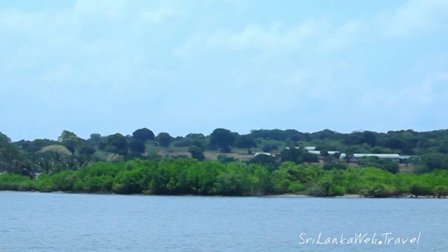 |
Kala Oya Estuary Location: 80 22’ 0 N and 790 54’ 0 E to 80 12’ 0 N and 790 57’ 0 E; 925003 N and 378884 E to 906559 N and 384342 E; adjacent to the Puttalam estuary and Dutch Bay, within the Puttalam District; North-western Province. Area: 1,837 ha of riverine mangrove Altitude: Sea level Overview: Kala Oya estuary is a bay estuary, as the main stream of the Kala Oya and its tributaries discharge freshwater into the Dutch bay before entering the sea. The estuarine area includes the brackish water areas of Kala Oya, Dutch Bay and the Puttlam estuary. The amount of freshwater received is controlled by the water retention capacities of the tank system within the Kala Oya basin. Kala Oya estuary harbours the largest tract of intact riverine mangrove in Sri Lanka. This ecosystem functions as an important breeding ground for many marine species and is rich in biodiversity. Presently, the Kala Oya estuary is in good condition as the area is sparsely populated and partially borders the Wilpattu National Park. Physical features: As the area lies within the dry zone of the country, the temperature varies between 30.4 –33.60C with an average monthly rainfall of 120 mm. The highest rainfall occurs from November to December (225 mm) while the driest periods are characterized by as little as 25 mm of rainfall per month. The estuarine system is very shallow, with depths of 1.5-3 m, except in the deep channels, where depths of 4-5 m have been recorded. The major sources of freshwater are the tanks in the Kala Oya basin. Ecological features: The Kala Oya estuary supports a healthy mangrove ecosystem distributed over a wide area along the banks of Kala Oya, Lunu Oya and other streams. This mangrove forest is the largest in the country and extends upstream about 2 km from the river mouth. As in many other mangrove ecosystems in the dry coastal regions of Sri Lanka, Rhizophora mucronata and Avicennia marina are the major constituent species. Due to differences in depth, salinity and biodiversity, the estuarine system can be differentiated into two major parts, the outer estuary and the inner estuary. The area between the mouth of the estuary and the brackish water area of the Kala Oya is considered the inner estuary, while the Dutch bay and Puttalam estuary area is considered the outer estuary. Saltmarshes are situated behind the mangroves and the stability of this ecosystem depends on the salinity in the soil. Sea grass beds are found in the Dutch bay. The distribution and abundance of the estuarine fauna is dependant on the tidal influences. About 55 fish species belonging to 33 families and 8 shellfish species belonging to 2 families have been recorded from the Puttalam estuarine area, including the Kala Oya estuary. Noteworthy fauna: The estuary harbours a variety of fish species, including freshwater and brackish water forms. Common species of economically important fish include Anguilla bicolor, Etroplus suratensis, Chanos chanos, Oreochromis mossambicus, Mugil cephalus Sardinella spp., and Caranx spp. The estuary supports fairly healthy populations of locally declining non-fish vertebrates such as colony-nesting water birds (i.e. Pelecanus philippensis), reptiles (Acrochordus granulatus, Crocodylus palustris, Lissemys punctata) and mammals (i.e. Lutra lutra). Crustaceans form an important component of invertebrate fauna associated with the mangals, including Portunid crabs such as Scylla serrata, Portunus pelagicus and Macrophthalmus spp. Besides, penaeid shrimps and the mud lobster Thalassina anomala are also present. A noteworthy mollusc is Geloina coaxans, which is an edible bivalve. Noteworthy flora: The two major constituent mangrove species in this area are Avicennia marina and Rhizophora mucronata. Other true mangrove species such as Brugueira cylindrica, Exoecaria agallocha, Lumnitzera racemosa, Rhizophora apiculata and Sonneratia alba are commonly found in the area. Land use: Wetland resources are primarily used for subsistence purposes. Artisanal fisheries for fish, shrimps and crabs are done at a low capacity, although a few use destructive fishing gear. The local communities collect fuel wood from the surrounding areas while some people are engaged in small-scale sand mining operations. Possible changes in land use: The growing pressure to establish more prawn farms in the tidal zone would hinder the tidal exchange and lead to the depletion of the mangroves. A decline in the rainfall trends in the lower basin area such as Puttalam has been reported, which will lead to less freshwater inputs to the estuary. The improvement of the roads leading to Gange wadiya from Eluwankulam has increased accessibility to Kala Oya estuary and hence the number of local-holiday makers reaching the area. They use boats to reach upstream areas of the Kala Oya. This should be monitored and necessary action taken to ensure regulation in the number of visitors. A proposal has been made to construct a shrimp farm in the salt marsh/mangrove area near Iliya, close to Eluwankulam-Gange wadiya road, which is a potential threat to the whole estuarine ecosystem. Hydrological and biophysical values: Principally this estuary plays a vital role in flood prevention in the lower lying areas. Additionally, the nutrient rich wetland acts as a nursery and feeding ground for a multitude of fish and shellfish species. Social and cultural values: The mangroves are cut to fulfill requirements for timber, particularly in the villages of Gange wadiya and Eluwankulam. The use of gill nets, harpoons and traps is common in the estuary and upstream, but the number of river fisherman is less than the number of lagoon fisherman. There are several fishing camps in the area e.g. Gange wadiya. The territoriality of the local fishermen discourages those from other villages from trespassing, which in turn prevents the overexploitation of resources. After the meat of the edible bivalve Gelonia coaxans is extracted, the shell is used for making lime. Scientific research and monitoring: Institutions such as the MASL, CEA, NARA, IWMI, IUCN and Sri Lanka Wildlife Conservation Society have conducted various studies in the area. According to NARA the extent of mangrove and salt marsh vegetation in Serakkuliya, Karathivu and Gange wadiya have not changed significantly over the years. Conservation education: Information not available Recreation and tourism: With the re-opening of the Wilpattu National Park in 2003 the number of tourists traveling to the area has increased. Although there are no tourist hotels in the vicinity, around 300 tourists from the Kalpitiya area visit the estuary by boat. Conservation measures taken: IUCN in collaboration with the DS office of Wanathavilluwa established a revolving fund to provide loans to fisherman. This scheme intends to discourage the use of destructive fishing gear by providing easy access to alternate fishing equipment. Additionally, two training programmes on boat repairing and crab fattening were conducted under the same project. The environment and wildlife of this area is relatively well protected primarily due to the presence of a police camp in the vicinity. Conservation measures proposed: IUCN has proposed a large marine and coastal Ramsar wetland site, which includes the Kala Oya estuary. Zoning of the area for tourism, protection, mangrove rehabilitation and fisheries related activities has also been proposed. Disturbance and threats: Clearance of mangrove forests in the inner part of the Kala Oya estuary for fuel and timber is a growing concern. This is clearly evident in the area bordering the Gangewadiya fisheries village, where part of the southern border of the estuary is devoid of mangroves. Use of detrimental fishing practices (i.e. push nets, blast fishing) affects aquatic biodiversity in the estuary. Excessive sediment loading during the rainy season is also a concern, and Gange wadiya is increasingly becoming unsuitable for brackish water fisheries due to the silting of the river. This has caused the river mouth area to decrease from 15 ft to 2 ft within a 30-year span. Sand mining and unsustainable harvesting of bivalves from the mangrove areas are also threats to the estuary. Although this area escaped destruction due to the civil unrest in the area, the increased access after the CFA has led to an increase in the number of visitors interested in hunting and camping. Land tenure: The estuary is State owned. Surrounding home gardens and cultivated lands are privately owned. Management authority and jurisdication: GA of Puttlalam District. The DWC has jurisdiction over the area falling within the Wilpattu National Park. References: MASL (2005); Perera et al. (2005) |
| Maps |