 |
Home About Directory Conservation |
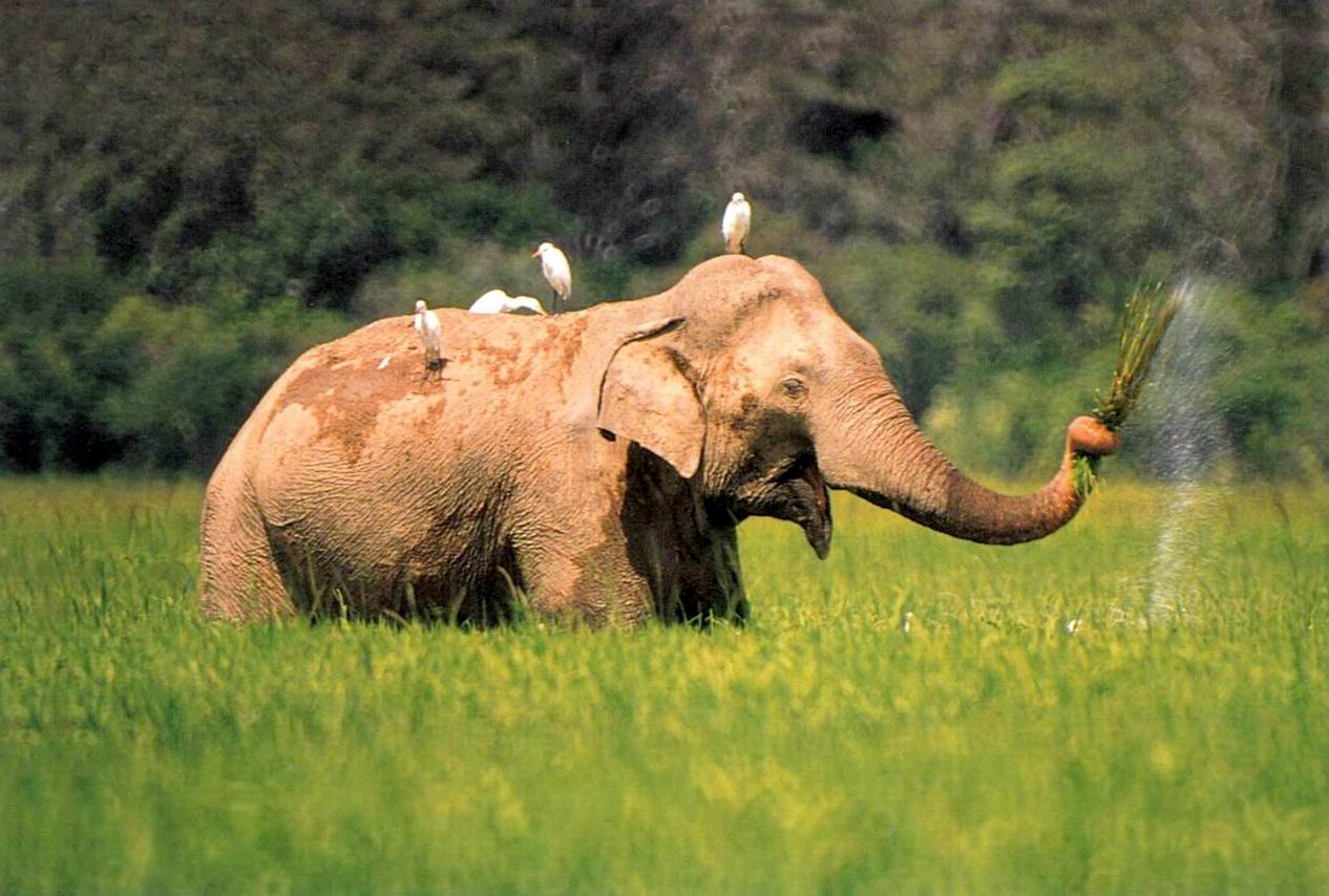 |
Lahugala and Kitulana Tanks Location: 060 56’ 0 N and 800 39’ 0 E to 60 51’ 0 N and 810 46’ 0 E; 766428 N and 571805 E to 757235 N and 584708 E; 12 km southwest of Pottuvil in the Ampara District of the Eastern Province. Area: Approximately 400 ha. Altitude: Near sea level. Overview: Lahugala-Kitulana National Park is one of the smallest parks in the country. Lahugala and Kitulana, small water storage reservoirs along with a third called Sengamuwa are located about 7km inland from the coast within the Heda Oya basin. Physical features: Tropical monsoonal climate with an average annual rainfall of approximately 1,650mm. Ecological features: These closely clustered tanks are surrounded by dry zone forest. The park has a flat terrain with occasional outcrops. Although the park is small in extent it provides an important grazing area for a large number of elephants that annually move to this area from outside to feed on a tall reedy grass, Beru (Sacciopelsis interrupta), that covers the tank extensively. Herds of over 150 elephants are a common sight from July to August. Noteworthy fauna: Among the freshwater fish in the tank, Clarias brachysoma is endemic. Endemic amphibians around the tank include Bufo athukoralei, while aquatic reptiles include the freshwater turtles Melanochelys trijuga and Lissemys punctata. Large water birds that visit the tank include Pelecanus philippensis, Leptoptilos javanicus, Anastomus oscitans and Ciconia episcopus. Large herds of Elephas maximus visit the tank regularly to feed on the lush vegetation. Noteworthy flora: The dry zone forest that surrounds the tanks is made up of species such as Hemicyclia sepieria and Manilkara hexandra. The dominant grass species Sacciopelsis interrupta is a major food source of the elephant. Land use: The Park is uninhabited but there is a small settlement on the boundary. Villagers engage in paddy cultivation and fisheries activities. The Pottuvil to Moneragala trunk road runs through the southeastern sector of the park. Possible changes in land use: Information not available Hydrological and biophysical values: Information not available Social and cultural values: The historic site of Magulmahavihara, which was built in remembrance of the marriage between King Kavantissa and Princess Viharamaha Devi, is located close to the National Park. Scientific research and monitoring: Research on elephant ecology was carried out in 1967-1969. A project titled ‘Saving Elephants by Helping People: Mitigating human-elephant conflicts along the southern boundary of the Lahugala-Kitulana National Park for the long-term conservation of the Sri Lankan elephant (Elephas maximus maximus)’ was initiated in 2003, through funding from the US Fish and Wildlife Asian Elephant Conservation Fund. Conservation education: Information not available Recreation and tourism: The park was closed due to security reasons until 2000. The current civil unrest could possibly lead to its closure again. Conservation measures taken: The tanks are located within the Lahugala-Kitulana National Park (1,554 ha), which was declared under the FFPO in October 1980. The area was initially protected as a Sanctuary in July 1966. In 2005, a 15km solarpowered electric fence was erected by the DWC in four villages situated along the southern boundary of the Lahugala-Kitulana National Park to prevent raiding by wild elephants. Conservation measures proposed: Information not available Disturbance and threats: Amongst the threats that affect the surrounding habitats, cattle grazing is the most prominent. Additionally people from the surrounding villages engage in illegal activities such as timber felling and poaching. Land tenure: The tanks and surrounding area are state owned. Management authority and jurisdication: DWC References: Kotagama (1989) |
| Maps |