 |
Home About Directory Conservation |
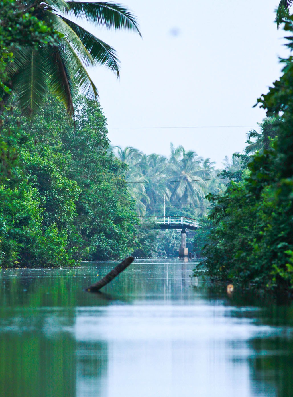 |
Negombo Estuary Location: 70 12’ 0 N and 790 50’ 0 E to 70 6’ 0 N and 790 55’ 0 E; 796023 N and 371187 E to 784943 N and 380363 E; along the western coast in the Gampaha District, of the Western Province. Area: The extent of the estuary is 3,502 ha. Altitude: Sea level Overview: Negombo estuary is a very productive shallow coastal body of water, receiving fresh water from the Attanagalu Oya drainage basin via Dandugam Oya and Ja-Ela and connected with the sea by a single narrow opening. There are 13 islands within the inter-tidal channel segments of the estuary of which four are inhabited. The estuary is multi-functional but is threatened by accelerated and haphazard infrastructure development. It is interconnected with the Muthurajawela marsh. Physical features: The estuary is approximately 12.5 km in length and 0.6 to 3.6 km wide. It has a mean depth of 0.65 m and a surface area of 35 km2. The tidal amplitude in the estuary is on average less than 20 cm. Seasonal fluctuations in water level are around 30 cm and are higher than the tidal fluctuations. The area is affected by two periods of heavy rains occurring in April/May and in October/November, immediately preceding and following the Southwest monsoons. Daily maximum rainfall can be as high as 340 mm. Salinity ranges from 1 to 40 ppt and the pH from 5.8 to 8.8. The average daily temperature is 270C and relative humidity is approximately 80%. Ecological features: Apart from the phytoplankton, the estuarine vegetation can be divided into two main types, namely, fringing types (mangroves and reeds) and submerged types (sea grasses and filamentous green algae). The low tidal variations have confined the mangroves to a narrow band of about 10m. Excessive reed beds mainly consisting of Phragmites karka exist along the southern border of the estuary, where the salinity is low and the mangrove vegetation has depleted. The submerged sea grasses constitute critical nursery habitat for the fish and crustaceans. Noteworthy fauna: Four penaeid shrimp species (Penaeus indicus, P. monodon, P. semisculcatus and Metapenaeus dobsoni), and two crab species (Scylla serrata and Portunus pelagiucs) are of high economic value. Noteworthy flora: The filamentous green algae Chaetomorpha spp is an indicator of the presence of high levels of nutrients in the estuary. It forms a thick mat and smothers the sea grass beds, which die off due to a lack of sunlight.The mangrove species observed on the islands include Ceriops tagal (most dominant species), Avicennia marina, Luminitzera racemosa, Bruguiera gymnorhiza, Rhizophora mucronata and Rhizophora apiculata. The latter two species are highly valued in brush pile fisheries. Land use: The estuary is mainly used for estuarine and coastal fisheries, for the anchorage of fishing boats (mainly in the channel) and for conservation purposes (particularly the five mangrove islands). The surroundings are mainly used for human settlements and industries. Possible changes in land use: During the last 50 years nearly 800 ha of the estuary has been reclaimed by people for various activities. Unauthorized settlement expansion towards the intertidal sand shoals in the channel segment of the estuary has had serious impacts upon its hydrology. Haphazard development of piers and landing points for fishing boats has caused alterations in flow patterns and sedimentation. Hydrological and biophysical values: The volume of discharge varies seasonally with rainfall and regulates variations in salinity and nutrient flow to the sea. The dynamicity of the ecosystem is controlled by the tides and river flow. Twice daily tidal changes and biannual flushing by freshwater (through the flooding of Attanaglau Oya during the rainy seasons) takes place within the estuary. The relatively stable period in this wetland coincides with the winter migration of birds, and as a result the ecosystem serves as an important habitat for migratory birds within the wet zone of Sri Lanka. Social and cultural values: Fishing is the primary source of income for over 3,000 families in the 26 villages bordering the estuary. Unemployment and poverty have lead to over-exploitation of resources. Scientific research and monitoring: The estuary is an important site for field research and numerous postgraduate and undergraduate studies have been carried out based upon the diverse ecological and socio-economic aspects of the wetland. A study on the fishing gear used in the Negombo estuary conducted in 2004 provides recommendations for the major fishing gear types and fishing practices such as trammel net fishing, cast net fishing, brushpile fishing, stake seine net fishing, gawana del fishery, gok-ren del fishery and crabtraps. It has also become a site for regular visitation by students from Dutch universities. Conservation education: Nearly 10 ha of mangrove area are used for educational purposes while research is conducted in Kadokele by NARA. Recreation and tourism: The scenic beauty of the estuary has attracted a large number of tourist resorts to the area and the hotel capacity has increased from 120 rooms in 1973 to 1,200 rooms in 1987. A boat trip on the estuary is one of the main attractions for tourists. Conservation measures taken: Negombo estuary was declared a FMA under FARA of 1996 and the Management Plan for the lagoon, which is now being implemented, was approved in 1998. The Negombo estuary management authority was gazetted under the Fisheries Act of 1996 to manage activities within the estuary area. Five mangrove islands (51.3 ha in extent) in Munnakkare area within the estuary were declared as conservation forests in September 2002 under the Forest Ordinance. In 1991, the Greater Colombo Economic Commission (now the Board of Investment) prepared the Master Plan for the Muthurajawela marsh Negombo estuary wetland complex, which was approved by the Government in 1992. In 1994 the CEA prepared a Conservation Management Plan for Negombo estuary and Muthurajawela marsh. Conservation measures proposed: The conservation management plan produced by the CEA in 1994 recommends certain conservation measures. Additionally, other management plans such as that by the Greater Economic Commission (Board of Investment) and the CCD also provide similar recommendations. Disturbance and threats: There is a continuing reduction in water depths in the narrow inlet/exit channel of the lagoon as a result of the sedimentation caused by unauthorised landfill and unplanned development along the water front and the upstream areas of the Attanagalu Oya. Since the early 1980s haphazard construction of piers and landing points for large sea going boats in the channel segment of the lagoon have caused alterations in the flow patterns and increased sedimentation. The reduction in the inlet/exit channel directly reduces the tidal exchange and flushing. This in turn decreases the lagoon water quality and causes more frequent algal blooms especially during the dry season. Additionally, there is increased oil pollution from fishing vessels, extensive fishing, felling of mangroves and encroachment of the wetland area. Urgent actions need to be taken to mitigate existing threats. Land tenure: State owned. There is also privately owned land in the islands. Management authority and jurisdication: The estuary comes under the purview of the DFAR and the Negombo estuary Management Authority while the conservation forests are managed by the Forest Department. References: CCD (2005b); CEA/ARCADIS Euroconsult (1994f); IUCN (1996); Jayakody (2004); Kumara et al. (2003); Samarakoon and van Zon (1991) |
| Maps |