 |
Home About Directory Conservation |
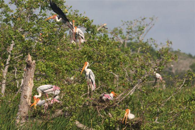 |
Puttalam Estuary Location: 80 2’ 0 N and 790 40’ 0 E to 80 0’ 0 N and 790 52’ 0 E; 888222 N and 353067 E to 884470 N and 375100 E; 120 km north of Colombo in the Puttalam District, of the North-western Province. Area: The estuary is 36,426 ha while the surrounding mangroves and salt marshes cover an extent of about 600 ha and 700 ha respectively Altitude: Sea level Overview: The estuary is the second largest in the country and is one of the most productive basin estuaries, being important for its finfish and shellfish fisheries. The shallow wetland is connected with the Mundel lagoon through the Dutch canal and opens out to the Indian Ocean at the northern end through the Dutch bay. The mangroves of the Kalpitiya peninsula border the Puttalam estuary on its western end. A number of islands (e.g. Erumathivu, Battalangunduva, Karativu) near the mouth of the lagoon are temporarily or permanently inhabited by fishermen. This area is very rich in biodiversity, as it contains a range of habitats including mudflats, mangroves, saltpans, salt marshes, sea grass beds and coral reefs. Physical features: As the area lies within the dry zone of the country, the temperature varies between 30.4 –33.60C and the area experiences an average monthly rainfall of 120 mm. The highest rainfall occurs from November to December (225 mm) while the driest periods are characterised by as little as 25 mm of rainfall per month. The estuary is very shallow, with depths of 1.5-3 m, except in the deep channels, where depths of 4-5 m have been recorded. The average tidal period is 12 hours and 40 minutes, with a longer ebb period, and the average tidal range is about 0.25 m. The tidal patterns in the Puttalam estuary do not occur in rhythm with that of the Indian Ocean. Monsoon winds play a significant role in tidal movements, and the highest tidal ranges are recorded during the northeast monsoon. The salinity of the water body varies widely from 34ppt to 55ppt and it is exceptional amongst estuarine lagoons in that the salinity rarely decreases below 15 ppt, even during the rainy season. Average humidity in the area ranges from between 75.9% in the day time to 88% at night. The predominant soil type in Kalpitiya is sandy regosols. Due to its sandy character, the soil is very permeable, well-drained and aerated. Throughout the area the ground water is found at a depth of 2-5m but due to its high salinity it is not suitable for drinking purposes. Ecological features: Several natural and man-made terrestrial and wetland habitats have been recorded from the estuary and its surrounding environs. The natural wetland ecosystems associated with the estuary include streams, mangroves, sea grass beds, mud/tidal flats, coral reefs, salt marsh, and seashore vegetation. These wetlands are surrounded by natural terrestrial vegetation (dry monsoon forests, and dry thorny scrublands), and human influenced habitats (coconut/banana/cashew cultivations, shrimp ponds, home gardens, and teak plantations). Fringing mangroves are predominantly found in the larger islands in Puttalam estuary and Dutch bay and in a few locations on the mainland (Pallivasalthurei, Tannikudah, Kuringipiti, Mandalakudah, Kovilkudah, Keerimundel, Serakkuli and Karathivu areas). Small patches of over-washed mangroves, i.e. fringing mangroves located in small islands or patches of mud flats that get completely submerged during every high tide, occur around Kungimathottam area. Scrub mangroves can be found along the mainland shoreline towards more saline upper inter-tidal areas. Scattered and stunted Avicennia marina plants are characteristic of these mangrove ecosystems. A total of 14 exclusive or true mangrove plant species and 29 species of mangrove-associated species have been reported from Puttalam lagoon and Dutch bay. Salt marshes are closely associated with the mangroves in this dry climatic region. Extreme soil salinities that prevail in these inter-tidal soils have given rise to vegetation consisting of salt-tolerant herbaceous plants (halophytes), and five species have been recorded from these habitats. Eight species of sea grasses have been recorded from the sea grass beds associated with the estuary. The mudflats are sedimentary intertidal habitats created by mud deposition, particularly in sheltered areas of the estuary. Their sediment consists mostly of silts and clays with a high organic content. More than 50 species of fish, including fresh and salt-water forms have been recorded from the estuary. Among the other vertebrates, more than 100 species of birds have been recorded from the Puttalam estuary and its associated wetlands, dominated by water birds. Noteworthy fauna: Common food fish caught from the estuary include Nematalosa nasus, Hilsa keeli, Mugil cephalus and Chanos chanos. The cartilaginous fish recorded from the estuary includes sharks (i.e. Chiloscyllium griseum, Carcharhinus spp.) and rays (Aetibatus narinari, Rhinoptera javenica). Among marine mammals, Sousa chinensis and the globally endangered Dugong dugon are known to visit the estuary. Economically important prawn species (Penaeus semisulcatus and P. indicus), and crab (Portunus pelagicus) form a major component of the export market. Bivalves such as Gafrarium tumidum, Marcia opima and M. biantina are commercially important. The estuary harbours fairly large populations of migratory water birds, including terns (i.e. Gelochelidon nilotica, Sterna hirundo, Thalasseus bengalensis), waders (i.e. Charadrius mongolus, Charadrius leschenaultii, Tringa tetanus, Calidris alba), and locally declining large water birds such as Pelecanus philippensis. Among the noteworthy marine reptiles that inhabit and/or visit the estuary are sea snakes (Enhydrina schistosa and Pelamis platurus), and two species of globally endangered turtles (Chelonia mydas and Lepidochelys olivacea). Noteworthy flora: Among the mangrove species, the two major constituent species in this area are Avicennia marina and Rhizophora mucronata. Out of the mangrove species, Scyphiphora hydrophyllaceae is very rare and is present only on the western shore of the estuary. Sonneratia alba, Aegiceras corniculata, Ceriops tagal, Bruguiera cylindrica, Excoecaria agallocha and Lumnitzera racemosa are also commonly found in the area. Puttalam estuary has a well-developed sea grass community of which the two most common species are Cymodocea rotundata and Enhalus acoroides. Additionally, there are extensive growths of the edible seaweeds Gracilaria edulis and G. verrucosa which can be found mostly towards the Kalpitiya area but do not appear to be harvested commercially. Common plants in salt marshes include Sueda spp. and Salicornia brachiata Land use: More than 2,000 fishing families utilize the estuary and the coastal waters for seasonal fisheries, which is the most important commercial activity in the area. Shrimp farming is another important economic activity in the estuary although around 50% of the farms in operation are actually illegal. Collection of seaweed and ornamental fish, and mangrove extraction also takes place. Mangroves are harvested for the manufacture of fishing gear, fishing boats, houses, charcoal and for firewood. The barks of some species such as Rhizophora mucronata are used for tannin production. The agricultural activities include cash crop(coconut, cashew and vegetables) cultivation and subsistence farming. Around 20% of the land area is used for homesteads and agricultural crop cultivation (mainly coconut). Animal husbandry (cattle, goat, poultry and pigs) is also a popular activity. Possible changes in land use: At present, the government of Sri Lanka has identified this area as a tourism development zone, which could lead to reclamation and/or conversion of wetlands. Haphazard tourism development can be a threat to the wetlands and associated biodiversity. The islands in particular will be vulnerable to such tourism development activities. Hydrological and biophysical values: This estuary plays a role in flood control and acts as a source of water for the shrimp farms as well as the ‘sink’ for their waste effluents. The estuary is also important in driving the nutrient cycle and food chain in nearby coastal waters including the Bar Reef Marine Sanctuary. Social and cultural values: After the start of the civil unrest in the northern part of Sri Lanka, a large number of people migrated to the area as refugees (10% of the population in 2002). The socio-economic condition of many of the local communities in the area is relatively poor. The Church, Port and Fort located in the vicinity are of historical significance as they were constructed during the Dutch period. In the vicinity of Kandakuliya there is an ancient site called ‘Gange’ which is reported to have been occupied by the sister of Kuweni, the wife of King Vijaya, the first Sinhala King. Scientific research and monitoring: NARA has a regional research station at Kalpitiya which is used to conduct research on the lagoon. In 2003/2004, IUCN conducted two pilot projects on seaweed and mangrove growing in collaboration with NARA. As this site belongs to the Bar Reef area that was selected for SAM by the CCD, a comprehensive survey of the area was conducted during 2005. Conservation education: Information not available Recreation and tourism: Tourism in the area has been low due to the uneasy security situation in the country. However, following the cease fire agreement of 2002 the Government identified this area as a site for tourism development. Unfortunately, the recommencement of hostilities could hinder any such development in the near future. There is one guesthouse with three rooms in the Kalpitiya Peninsula, which does not cater to tourists and another guesthouse that was established in 2004. Conservation measures taken: The mangroves of the Kalpitiya Peninsula have been selected for SAM as a subcomponent of the Bar Reef area by the CCD. Of the mangrove areas around the estuary, one location (Kuringnampitiya North Forest Reserve) is a protected area of the forest department. Mangrove restoration activities have also been implemented by local CBOs and NGOs. Conservation measures proposed: IUCN has proposed a large marine and coastal Ramsar wetland site, including the northern part of the Puttalam estuary and its mangrove islands. The entire Puttalam estuary has also been proposed as a SAM site by the CCD. Disturbance and threats: Clearance of natural habitats and reclamation of wetlands for housing, aquaculture and agricultural expansion have been major conservation issues for many years. The spread of invasive alien plants (Opuntia dillenii and Prosopis juliflora) is also seen as a threat to the existing habitats such as salt marshes. Conflicts between fishermen for limited fishery resources and landing sites, use of destructive fishing gears such as small mesh-monofilament gillnets, monofilament purse seine nets, encircling nets, push nets and pull nets has a negative impact on the fish stocks and sea grass beds. Poaching of turtles and incidental by catch related mortality of turtles, dolphins and sea snakes are also threatening these endangered species. Shrimp farms pose the largest threat to natural habitats in the area. Shrimp farming in the estuary commenced in 1984 and by 1992 approximately 44% of the mangroves on the eastern shore and 28% of the mangroves on the western shore had been destroyed. Such clearing has led to a decrease in the water bird populations due to habitat loss. Additionally, the discharge of nutrient-rich effluents from these farms pollutes the estuary resulting in eutrophication of the water body and pollution of ground water. Seaweed is collected for commercial purposes but due to the limited natural stocks and seasonal production there are constraints on maintaining a continuous supply to meet the demand. Heavy exploitation for export therefore will cause a decline in the stocks, possibly to unsustainable levels. Unauthorised construction around the lagoon is also a potential threat. Need urgent action to mitigate existing threats. Land tenure: The estuary is state-owned while there is some private ownership in the surrounding areas. Management authority and jurisdication: This area is under the purview of the DS. The Kuringnampitiya North Forest Reserve is administered by the Forest Department. References: CCD (2006a); CEA/ARCADIS Euroconsult (1999); Dayaratne et al. (1997); IUCN (2003c); IUCN (2005b); Kotagama et al. (1989); Madduma Bandara (2002) |
| Maps |