 |
Home About Directory Conservation |
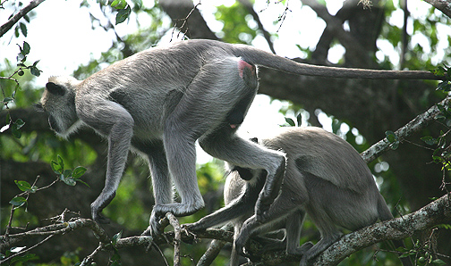 |
Ruhuna National Park Location: 60 40’ 0 N and 810 12’ 0 E to 60 16’ 0 N and 810 44’ 0 E; 736905 N and 522106 E to 692739 N and 581119 E; in the south-eastern region of Sri Lanka extending over the Moneragala District of the Uva province and the Hambantota District, of the Southern province. Area: The park area is 97, 881 ha (Block I – 14, 101 ha; Block II- 9,931 ha; Block III – 40, 775 ha; Block IV – 26, 418 ha; Block V – 6,656 ha) Altitude: 0 – 160 m Overview: Ruhuna National Park (Block I to V) is one of the largest agglomerations of protected areas in Sri Lanka. It comprises of a complex of freshwater and brackish water wetlands including seasonal freshwater ponds, large and small abandoned tanks, waterholes, rivers and seasonal streams, coastal lagoons, estuaries, small patches of mangroves and marshes which are spread out within the park (mainly within Blocks I and II). The area is very rich in biodiversity and important for elephant and water bird conservation and as such is considered an IBA by BirdLife International. At present, the park is the most important destination for nature tourism in the country. Owing to the availability of water, and flat terrain, scrub vegetation and grassland, animals can be seen in large numbers in Block I. Physical features: The geology of the area is composed almost entirely of metamorphic rocks belonging to the Pre-Cambrian age and can be categorized into two main series: Vijayan series, and the highland series. Out of the 6 soil types identified, reddish brown earths and low humic gley soils are prominent in the area. The area is situated in the lowest peneplain of the island, which stretches from Trincomalee to the Hambantota coastal plain. The land is a flat and gently undulating plain that stretches down to the coast with a height of less than 30 m but rises inland to 100 –125 m above sea level. Situated in the dry semi-arid type of climate, the major rainy season is the northeast monsoon. The mean annual rainfall varies between 500 –775 mm. The mean temperature range is between 26.380C in January to 300 C in April. During the year the wind speed varies from 15 km/h during the northeast monsoon to 23 km/h during the southwest monsoons. Although, the availability of surface water appears to be a critical factor in the National Park during the dry season, water becomes abundantly available after the onset of the northeast monsoons. The surface water within the park is present in the form of streams, tanks, waterholes, rock pools, lagoons and bays. Many of the waterholes have originated at places with natural depressions. Rock pools of varying sizes hold water, often throughout the year, and provide an important source of water for elephants. The natural waterholes provide ideal habitats for many water birds, wild buffaloes etc. The largest concentration of such reservoirs are found within Block I followed by Block II. Amongst the largest tanks are the Yodha Wewa (480 ha) and Badu Wewa in close proximity to Block I. There are a number of major and minor rivers and streams in the area that either originate in the highlands adjacent to the Hambantota District or from the central and Uva hills of the island and flow in a southeasterly direction. Kumbukkan Oya in the Northeast and Manik ganga and its tributaries in the west flow through the Park providing a source of water to the animals even during the driest months of the year. The other important streams are Kurunda Ara, Nabadagas Ara, Katupila Ara, Karambe Ara, Wila Oya, Maheseelawa Oya and Buthawa Oya. These streams usually dry up during the dry season. These rivers and streams show very high fluctuations in the runoff between wet and dry seasons. For example, the Kumbbukkan Oya carries seven times as much water to the sea in the rainy season than it does during the dry season. Mangrove vegetation is widespread in the estuaries of Manik Ganga and Kumbukkan Oya. Some of the important lagoons within the area are Buthuwa, Udapothana, Mahirawa, Etiliu and Udagajaba. Ecological features: The multifarious ecosystems ranging from moist monsoon forest, dry monsoon forests, semi deciduous forests, thorn forests, grasslands, fresh water and marine wetlands, sandy beaches etc. are home to a large number of animals and plants. Of the Block I area, 62% of the land area is under forest cover (50% open forests, 35% scrub forest and 15% dense forests) while 26% of the area comprises mainly of rangelands of open park country (Pelessa grasslands) including some extensive grasslands. While the forests are mostly confined to around the Manik Ganga, the principal rangelands are distributed towards the coast. Tanks and water holes represent 1.2% of the land area while lagoons and mangroves represent 1.6% and the beach 2%. Chena land occupies 6%. In the Buthuwa lagoon, mangrove vegetation primarily comprises of Rhizophora mucronata. The other less abundant species are Avicennia sp. and Aegiceras sp. In the Block II area, 42% is covered by forests, 32% by rangelands, and other habitats include natural water holes, lagoons, mangroves and beaches. The extensive Pitiya grasslands of Block II are mainly represented by Yala-wela, which was once a large expanse of fertile paddy land that was later abandoned. Mangroves in Block II with a total extent of 100 ha are mainly distributed around the Manik Ganga estuary. They are also found in the lagoon areas of Pilinnewa, Mahapothana, and Pahalapothana. The main mangrove species are Rhizophora mucronata, Sonneratia caseolaris, Avicennia spp and Aegiceras corniculatum. Block III comprises of 85% forests and 15% rangelands, while in Block IV, 95% is forest, out of which 84% is dense forest while 10% is scrub. In Block V, 4,415 ha (out of 6,650 ha) is covered by forest while 1,500 ha comprises of rangelands. 68% is dense forest. Trees such as Drypetes sepiaria, and Manilkara hexandra form the principal component of the main canopy. The Pitiya grasslands are important grazing areas. The dominant grass in Pitiya is usually Cynodon barbata, but the grass Zoysia matrella becomes dominant closer to the beach. The vertebrate fauna recorded from the area include 31 fish, 14 amphibians, 30 reptiles, 151 bird species, and 32 mammal species. Noteworthy fauna: Almost 90% of the fish population in the permanent reservoirs consist of the exotic food fish Oreochromis mossambicus. Among the other fish species, Garra ceylonensis and Esomus thermoicos are endemic. Breeding populations of two species of crocodiles (Crocodylus palustris and C. porosus) inhabit the wetlands of the park. The beach adjoining the National Park is a nesting ground for all five species of globally endangered marine turtle that visit Sri Lanka. At least 90 species of water birds inhabit the wetland habitats in the park, half of them being annual migrants. Common water birds include waterfowl (i.e. Dendrocygna javanica, Anas querquedula), cormorants (Phalacrocorax niger, P. fuscicollis), large water birds (Ardea cinerea, Threskiornis melanocephalus, Platalea leucorodia, Anastomus oscitans, Mycteria leucocephala), medium sized waders (Tringa spp.) and small waders (Charadrius spp.). Rare water birds include Ephippiorhynchus asiaticus, and Leptoptilus javanicus. The migrant Pelecanus onocrotatus has been observed in the lagoons with the resident Pelecanus phillipensis. The water holes cater to the water requirements of the wild animals within the park, including a large population of wild elephants (> 300). Noteworthy flora: A wild rice species (Oryza spp.) can be found in the seasonally inundated areas of Block II. Endemic plant species around the wetlands include Argyreia populifolia, Calanus rivalis, Carmona oblongifolia, Casearia thwaitesii, Cordia oblongifolia, Derris parvifolia, Glenia unijunga, Glossocarpa scandens, Gymnea rotundatum and Sanseveria zeylanica. Common medicinal plants include Munronia pumila, Salacia reticulata, and Asparagas racemosus. Land use: Within the National Park, the wetlands and their environs are protected for biodiversity conservation while Block I is also used for nature tourism. Illegal activities such as poaching, tree felling, chena cultivation and gem and sand mining have been observed within the Park. Permits are issued by the DWC to fishermen to fish around the coastal stretch of Patanangala from late September to early April. In the surrounding villages, people are involved in activities such as paddy and chena cultivation and animal rearing (mainly cattle and buffalo). Possible changes in land use: A main road planned across the park, linking Hambantota and Panama areas, could lead to clearance of vegetation along the pathway identified for the road. Hydrological and biophysical values: The wetlands provide an important water source for animals within the Park. Social and cultural values: A majority of the villagers around the park are farmers (rice and chena) that fall within the low-income category of the country and are dependent on the Samurdhi scheme. These villagers due to their circumstances are found to enter Block III and V to collect medicinal plants, fruits, food plants, rattan and bee’s honey. Seasonal fisheries activities are undertaken along the Patanangala coastal stretch through a permit system. The location of the National Park and its associated wetland clusters has great historical significance as it forms part of the Ruhu Rata, which was the southern kingdom of the Sinhalese kings. The presence of a large number of ancient albeit dilapidated tanks provides evidence of a rich hydraulic and agricultural civilisation dating back to 5th century BC. According to the Mahavamsa, the great chronicle of Sri Lanka, the Kingdom of Ruhuna began to decline by the end of the 13th Century AD. During the colonial period that extended from the 16-20th Century, the area became a popular hunting ground. Historical and religious sites such as Kataragama, Sithulpahuwa and Magul Maha Vihara are found in the vicinity. Scientific research and monitoring: Limited research facilities are available within the National Park. However, under the GEF funded wildlife conservation project, several short-term biodiversity surveys were carried out between 1995-97. Extensive research on vegetation and large mammals was carried out by the Smithsonian Institute as far back as 1969. In 1978, a team of students from the Universities of Colombo and Aberdeen carried out a joint biological survey in the coastal zone of Block I. More recently, there was a project to establish a tamarind tree fence around the park in the Buttala area to prevent elephants from moving out of the park, an assessment of the impacts of the tsunami by the University of Colombo, and two studies on the humanelephant conflict and impacts of gem mining. Conservation education: There is a small museum inside the park. Recreation and tourism: The park is very popular amongst nature lovers and is the most visited park in Sri Lanka. In 2002 around 156,867 tourists, both local and foreign visited the park. Block I is the main area for visitors, with six wildlife bungalows managed by the DWC. There are 2 campsites each in Block II and III. The park is closed to visitors from 1st September to 15th October due to drought conditions. According to the Safari Jeep Owners Association, around 110 jeeps are registered with the association, which provides full-time employment to 144 people. While most tourists visit the park to enjoy the wildlife, some come for educational purposes such as to produce films etc. Conservation measures taken: Ruhuna National Park consists of five blocks. Block I of the park was established in 1938, having previously been a resident sportsmen’s shooting reserve since 1900. Further blocks were established in subsequent years: Block II in 1954 (originally proclaimed as Yala Sanctuary in 1900), Block III in 1967, Block IV in 1969 and finally Block V in 1973. Yala east National Park, the Yala Strict Nature Reserve, and 3 Sanctuaries (Kataragama, Katagamuwa and Nimalawa) are continuous with the Ruhuna National Park. Management of grazing lands, conservation of small water ponds and eradication of invasive alien species are the activities that are currently being implemented by the DWC. A 40 km long electric fence was erected to prevent elephants moving out of the Park boundaries and into the nearby villages. Conservation measures proposed: The management plan developed under the GEF funded Protected Area Management and Wildlife Conservation (PAM-WC) project recommends the following conservation measures: zonation of the park into different areas (strict conservation, coastal conservation, intensive management, eco-development, tourism and cultural zone and administrative zone); rehabilitation of existing tanks and development of new ones to reduce pressure during the dry period; mitigation of genetic contamination of wild buffalo and development of ecotourism and alternative livelihoods for associated communities. Additionally, it is important to reduce visitor pressure on the park by restricting the number of visitors and vehicles permitted per day. Disturbance and threats: A large stand of Sonneratia caseolaris in the Manik Ganga estuary is faced with forest die back. Main conservation issues include poaching of animals; uncontrolled grazing by domesticated cattle and buffalo; illegal gem mining in the riverbeds; forest fires, which mainly spread from nearby chena land; uncontrolled tourism leading to noise and air pollution from the vehicles; cultivation of tobacco. Spread of invasive alien plant species such as Lantana camara, Opuntia dillennii and Chromolaena odorata pose threats to native species. The 2004 tsunami affected the coastal stretch, particularly in the Patanangala area. Land tenure: State owned Management authority and jurisdication: DWC References: BirdLife International (2005); DWC (2004); Kotagama et al. (1989); Panwar and Wickramasinghe (1997) |
| Maps |