 |
Home About Directory Conservation |
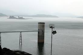 |
Senanayake Samudraya Location: 70 16’ 0 N and 810 22’ 0 E to 70 5’ 0 N and 810 40’ 0 E; 803245 N and 540476 E to 783014 N and 573622 E; straddling the border of the Moneragala District of the Uva Province and the Ampara District, of the Eastern Province. Area: 7,770 ha at full supply level Altitude: Approximately 80 m above sea level Overview: This wetland is primarily a large water storage reservoir created in 1951 by damming the Gal Oya at Inginiyagala as part of the Gal Oya Development scheme to open up 162,000 ha of forest for agricultural and industrial purposes. The tank is an important inland fishery source. The reservoir and its surroundings have been declared a Sanctuary, while the Sanctuary itself and the catchment of the wetland lie within the Gal Oya National Park. The area is rich in biodiversity. Furthermore this is an important habitat for elephants and water birds. As such, Birdlife International has identified this site as an IBA. Physical features: The reservoir has been classified as “deep, encompassing many valleys” as the wetland is a multi-fingered lake with 4 major basins and surrounded by hills. The reservoir is located in the Gal Oya basin, which covers an area of 179,200 ha. The catchment area of the reservoir alone covers about 100,000ha. The main river feeding the reservoir is the Gal Oya River. In addition to this, the reservoir is fed with water from seven main tributaries and 23 unnamed minor seasonal streams. The profusion of bays gives the reservoir an estimated shoreline of about 130 km at full supply level. The capacity of the reservoir is 949x106 m3 with a maximum depth of 33m and an average depth of 12m. The water level in the reservoir is subject to wide seasonal and annual fluctuations and is directly related to rainfall in the region. The lowest level recorded in the recent past was 28m below spill level in 1989; maximum depth in the reservoir at that time was 5m. The length of the dam is 1,093m with a crest at 83 m above sea level. The entire reservoir area is situated in the Vijayan series, a Precambrian formation prevailing in the eastern part of the country. The reservoir is situated in the dry zone of the eastern low country of Sri Lanka in the agro-ecological region DL2, which is defined as an area with a 75% expectancy of annual rainfall exceeding 900mm. Most rainfall is normally recorded in the period October-February; the period May-September is usually dry. Mean annual temperature is around 27.7 0C. Ecological features: The reservoir’s phytoplankton community is dominated by green algae such as Mougeotea sp, Cosmarium singulum, C. renifomi, Staurastrum tetracerum and S. singulum. Large stands of dead trees that were not removed before the impoundment can still be seen within the reservoir. Fringing areas of the reservoir other than those situated close to the dam are covered with grass, shrubs and forests such as dry evergreen mixed forest and savannah type grassland dominated by Cymbopogon confertiflorus and Themeda spp. The latter habitat is artificial and developed with logging in the bed of the reservoir. It is maintained by the regular inundation of the land. Noteworthy fauna: The reservoir has a rich diversity of freshwater fish, including native and exotic species. Oreochromis mossambicus, Labeo rohita and Osphronemus goramy are among the most common exotic species. Amblypharygodon melettinus, Esomus thermoicos, Puntius singhala and Clarias brachysoma are among the common indigenous species. This reservoir also serves as an ideal habitat for water birds, including migratory waterfowl during the migratory season. Phalacrocorax fuscicollis, Pelecanus philippensis, Anhinga melanogaster, Ardea cinerea and Dendrocygna javanica are among the common water birds in this reservoir. In addition raptors such as Haliaeetus leucogaster and Ichthyophaga ichthyaetus are regularly noted in this area. Aquatic reptiles such as Crocodylus palustris, Melanochelys trijuga and Lissemys punctata have been recorded in the reservoir. Large herbivores such as Cervus axis, Cervus unicolor and Elephas maximus can be seen in the grasslands fringing the reservoir. Noteworthy flora: The dry mixed evergreen forests adjacent to the reservoirs consist of noteworthy endemic species such as Diospyros attenuata, Dialium ovoideum, Munronia pumila and Syzygium cumini. Additionally, valuable medicinal plants such as Phyllanthus emblica, Terminalia belerica, T. chebula and Pterocarpus marsupium have also been recorded from the grasslands associated with the reservoir. Valuable timber species such as Diospyros ebenum, Manilkara hexandra and Chloroxylon swietenia are also found in the adjacent forest areas. Land use: Senanayake Samudraya is a source of water for irrigation, domestic use and fisheries activities. Under the Gal Oya Development Scheme, which began in 1949, the valley area around the park has been developed for agriculture. Paddy cultivation takes place both during the Yala and Maha seasons, and around 4,000 ha of the right bank is under sugarcane cultivation. Possible changes in land use: With the declaration of the reservoir as a FMA under FARA, more fingerlings will be introduced to the waterbody which in turn could lead to an increase in the number of fishermen using the resource. Logging and allocation of more land for agriculture would lead to the degradation of the catchment area of the reservoir. Hydrological and biophysical values: This reservoir is a valuable source of water for irrigation and it supports an important inland fishery. Social and cultural values: A thriving inland fishing industry associated with the reservoir supports the livelihood of the local communities. Senanayaka Samudraya was the largest and first reservoir to be built under the Gal Oya basin development scheme. Scientific research and monitoring: The National Park is mostly inaccessible, except by boat. A considerable amount of research has been carried out on the elephant population within the Gal Oya National Park. Additionally, NAQDA has conducted research activities including fish breeding within the tank. Conservation education: Information not available Recreation and tourism: There is a bungalow maintained by the DWC and a tourist hotel available at Inginiyagala for use by the general public. Conservation measures taken: The reservoir was declared as a Sanctuary in 1954. The catchment of the wetland lies within the Gal Oya National Park (25,900 ha), which was also established in the same year. The DWC enforces strict laws against bush meat consumption. The CEA developed a wetland site report and conservation action plan for this site in 1992. In 2005, the reservoir was declared a FMA under FARA, for the development of the inland fishery. The Irrigation Department has undertaken to rehabilitate the channels and the reservoir gates. Conservation measures proposed: The document prepared by the CEA recommends certain conservation measures. Disturbance and threats: Cattle grazing and plastic bag waste pollution were the most evident threats. Other threats include erosion and siltation of the reservoir due to the inadequate protection of the catchment area, the presence of extensive paddy cultivation areas and some poaching within the park. Food and medicinal plant collection and illegal timber felling from the surrounding forests and frequent fires in the surrounding savannah areas pose a major threat to the reservoir and its environs. Poor maintenance of reservoir gates and distribution channels has led to decreased water retention within the reservoir. Land tenure: The reservoir and surrounding areas are state-owned. Management authority and jurisdication: The reservoir is managed by the Irrigation Department while the surrounding area is under the jurisdiction of the DWC. The inland fisheries are regulated by DFAR. References: Amarasinghe et al. (1998); CEA/ARCADIS Euroconsult (1993c); DWC (2004); Hettige et al. (2000); Kotagama et al. (1989) |
| Maps |